Building Height Surveys
Accurate building height measurement for planning applications, telecommunications installations, aviation safety assessments and construction coordination. Non-invasive measurement from ground level using total station and laser technology.
Get a free quote- Ridge and eaves heights
- Floor-to-floor levels
- Parapet measurements
- Chimney heights
- Antenna and mast heights
- OS datum referencing
- Planning submission drawings
- Neighbouring building heights
Precise Height Data Without Access
Building height surveys provide accurate measurements of buildings and structures for planning submissions, telecommunications installations, aviation obstacle assessments and construction coordination.
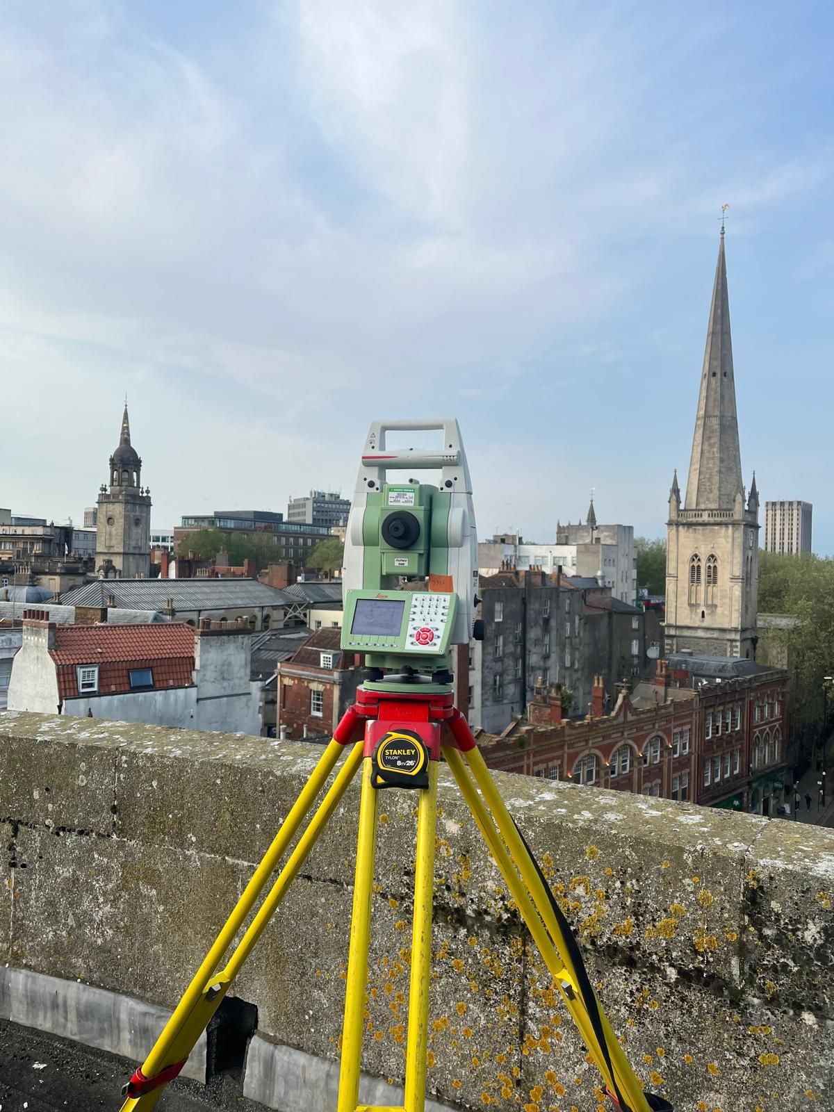
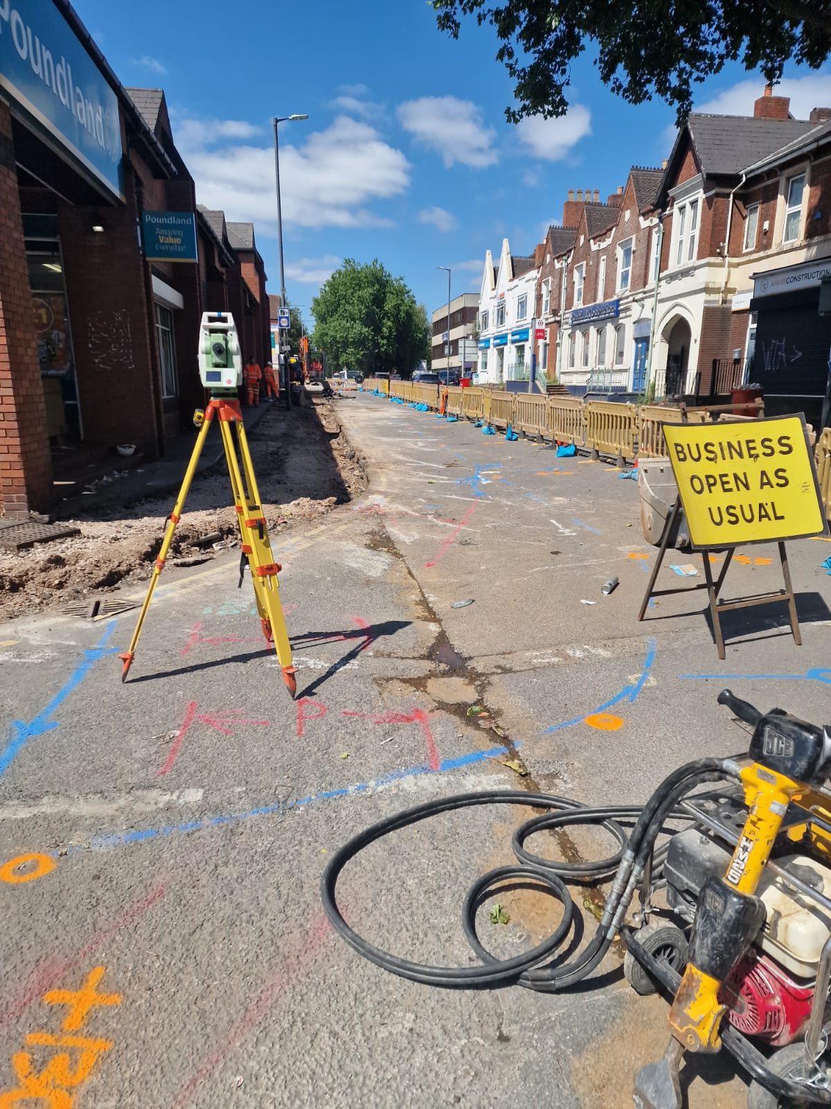
Our non-invasive approach uses reflectorless total station equipment and laser technology to measure heights from ground level. There’s no need for scaffolding, cherry pickers or physical access to roofs, making the process quick, safe and cost-effective.
Applications
Building height surveys are commonly required for:
- Planning applications where proposed building heights need to be demonstrated in context with neighbouring properties
- Telecommunications mast installations requiring accurate heights for coverage modelling
- Aviation safety assessments near airfields and flight paths
- Right to light assessments comparing building heights and shadow impacts
- Construction coordination where floor levels and building heights must be verified
- Insurance claims and boundary disputes involving building dimensions
Accuracy and Referencing
Our building height measurements are typically accurate to within 5-10mm using reflectorless total station technology. All heights can be referenced to Ordnance Survey datum (AOD) where required, providing absolute height values that are compatible with other survey data and design models.
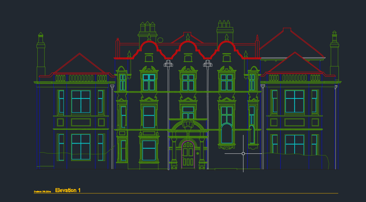
We can measure multiple heights in a single visit, including ridge heights, eaves levels, parapet tops, chimney heights, floor levels and any other features you need. Results are delivered as annotated drawings in CAD format.
What We Measure
Height data from ground level
Ridge & Eaves Heights
Precise measurement of roof ridge lines and eaves levels referenced to OS datum.
Floor-to-Floor Levels
Storey heights for each level, essential for interior fit-out and services coordination.
Neighbouring Heights
Heights of adjacent buildings for planning context, right to light and shadow analysis.
OS Datum Referencing
All heights referenced to Above Ordnance Datum for compatibility with design models.
How We Deliver Your Survey
Consultation
We review your requirements, assess the site and provide a detailed quotation.
Site Survey
Our qualified surveyors visit the site with the latest equipment to capture accurate data.
Data Processing
Raw data is processed, quality-checked and prepared in your required format.
Delivery
Completed survey data delivered on time, with full support for any follow-up queries.
The Red Box Advantage
Calibrated Equipment
Professional-grade instruments maintained and calibrated for accurate, defensible results.
Expert Surveyors
90+ years combined experience. CSCS certified, fully insured and professionally qualified.
Fast Turnaround
Most surveys completed and delivered within 5-10 working days. Rush options available.
Fixed Pricing
Clear quotes upfront with no hidden fees. You know exactly what you pay before we start.
Fully Accredited
SSIP, CHAS, CSCS certified. Members of The Survey Association with full professional insurance.
UK-Wide Coverage
Nationwide service from our head office in Cheshire with satellite offices across the UK.
Why Choose Red Box Surveys
90+ Years Combined Experience
Our senior management team brings over 90 years of surveying experience, ensuring every project meets the highest standards.
Nationwide Coverage
With satellite offices across the UK, we deliver efficient, cost-effective services wherever your project is located.
Latest Technology
We use advanced 3D laser scanning, GPS and GPR equipment to deliver precise, reliable data every time.
Frequently Asked Questions
We use reflectorless total station equipment and laser technology to measure heights from ground level. The instrument calculates height by measuring the angle and distance to the target point, eliminating the need for physical access to roofs or upper levels.
Typically accurate to within 5-10mm using reflectorless total station technology. For most planning and construction applications, this level of accuracy is more than sufficient.
Yes. We can reference all heights to Ordnance Survey datum (Above Ordnance Datum / AOD), providing absolute height values that are compatible with other survey data, design models and planning submissions.
Yes. We regularly measure the heights of neighbouring buildings for planning context drawings, right to light assessments and boundary dispute evidence. This can usually be done from public land without requiring access to the neighbouring property.
A typical building height survey takes 1-2 hours on site. Results are processed and delivered within 3-5 working days as annotated CAD drawings.
Get a free quote
Ready to discuss your project? Fill in the form and our team will get back to you with a detailed quotation, typically within 24 hours.