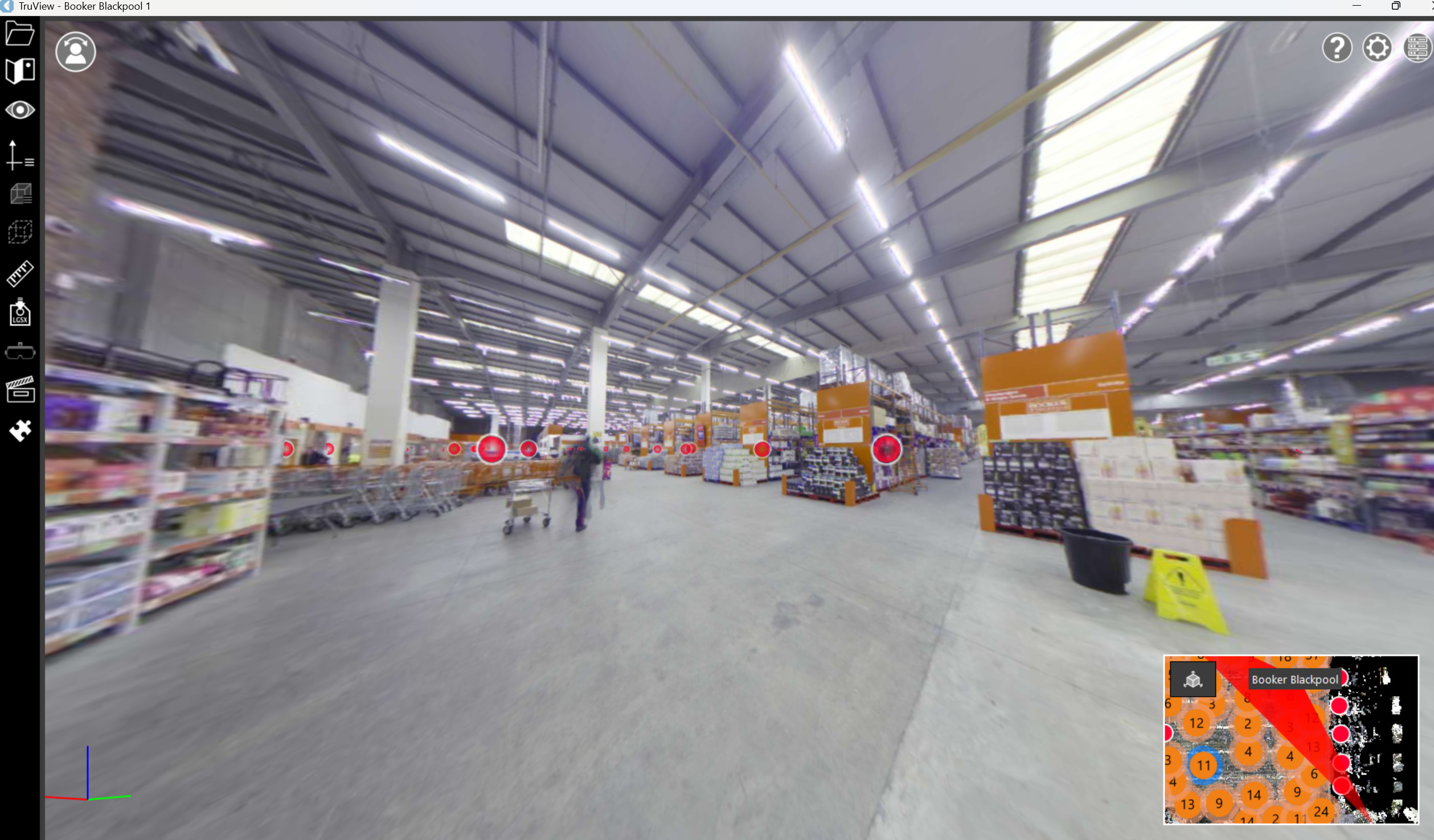
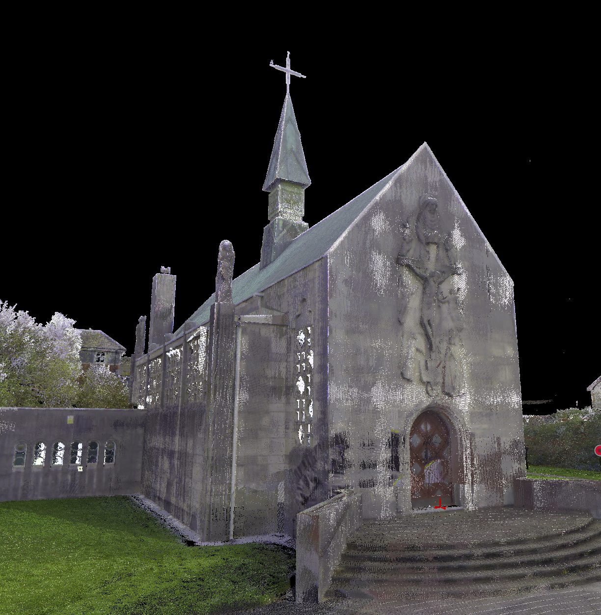
Point Cloud Surveys
We use professional 3D laser scanners to take millions of measurements, accurate to within millimetres. Floor layouts, ceiling heights, structural elements and every architectural detail captured in high-definition point cloud data.
Get a free quote- High-density point clouds
- CAD drawings from scan data
- Revit BIM models
- Floor plans
- Elevation drawings
- Section drawings
- 3D visualisations
- Deviation analysis
Millimetre-Accurate 3D Data
We scan your building and give you accurate 3D data, ready for CAD drawings, Revit models or whatever format you need. The data works for architectural design, engineering, manufacturing, digital modelling and most construction and design applications.
Point cloud surveys are ideal when there are no existing plans, when the ones you have don’t match what’s actually there, when you’re planning a refurbishment and need to know exactly what you’re working with, or for listed buildings and complex structures where precision matters.
From Scan to Usable Data
Our process takes you from raw scan data to production-ready deliverables:
- Planning: we assess your site and plan scan positions for complete coverage
- Scanning: our surveyors capture millions of data points from every angle
- Processing: raw data is registered, cleaned and optimised
- Delivery: we produce the drawings, models or datasets you need
The result is the quickest way to capture real-world conditions before you start any design or planning work.
Applications
Point cloud surveys support a wide range of applications:
- Architectural design: accurate as-built data for renovation and extension projects
- BIM modelling: creating Revit models from existing building geometry
- Heritage recording: capturing listed buildings and historic structures in detail
- Facilities management: maintaining accurate spatial data for building operations
- Manufacturing: capturing complex geometries for engineering applications
Output Formats
Data delivered in the format your team needs
Point Cloud Data
RCP, RCS and E57 formats for use in Revit, AutoCAD, Navisworks and other design platforms.
CAD Drawings
Accurate floor plans, elevations and sections extracted from the point cloud in DWG format.
Revit BIM Models
Intelligent 3D models built from scan data, ready for design coordination and clash detection.
3D Visualisations
Navigable point cloud viewers and fly-through videos for client presentations.
How We Deliver Your Survey
Consultation
We review your requirements, assess the site and provide a detailed quotation.
Site Survey
Our qualified surveyors visit the site with the latest equipment to capture accurate data.
Data Processing
Raw data is processed, quality-checked and prepared in your required format.
Delivery
Completed survey data delivered on time, with full support for any follow-up queries.
The Red Box Advantage
Calibrated Equipment
Professional-grade instruments maintained and calibrated for accurate, defensible results.
Expert Surveyors
90+ years combined experience. CSCS certified, fully insured and professionally qualified.
Fast Turnaround
Most surveys completed and delivered within 5-10 working days. Rush options available.
Fixed Pricing
Clear quotes upfront with no hidden fees. You know exactly what you pay before we start.
Fully Accredited
SSIP, CHAS, CSCS certified. Members of The Survey Association with full professional insurance.
UK-Wide Coverage
Nationwide service from our head office in Cheshire with satellite offices across the UK.
Why Choose Red Box Surveys
90+ Years Combined Experience
Our senior management team brings over 90 years of surveying experience, ensuring every project meets the highest standards.
Nationwide Coverage
With satellite offices across the UK, we deliver efficient, cost-effective services wherever your project is located.
Latest Technology
We use advanced 3D laser scanning, GPS and GPR equipment to deliver precise, reliable data every time.
Frequently Asked Questions
When there are no existing plans, when existing plans don't match what's actually there, when you're planning a refurbishment and need exact measurements, or for listed buildings and complex structures where precision matters.
We deliver point cloud data in RCP/RCS format for Revit, E57 for general use, LAS/LAZ for GIS applications, and can produce CAD drawings in DWG format and Revit BIM models. We'll work with whatever software your team uses.
Both produce accurate building data. A point cloud survey captures the raw 3D geometry of a space as millions of data points. A measured building survey produces finished drawings (floor plans, elevations, sections). We often use laser scanning as the data capture method for measured building surveys.
A typical building scan generates several gigabytes of point cloud data. We optimise the data for your intended use, reducing file sizes where full density isn't needed while maintaining accuracy where it matters.
Get a free quote
Ready to discuss your project? Fill in the form and our team will get back to you with a detailed quotation, typically within 24 hours.