Topographical Surveys
Accurate topographical data is vital for design, development and decision-making. We provide detailed, reliable site surveys that give you a clear understanding of existing ground conditions and features. Our expert team ensures every contour, level and boundary is captured with precision.
Get a free quote- 2D and 3D site plans
- Contour mapping
- Boundary surveys
- Level surveys
- Feature mapping
- OS coordination
- Drainage mapping
- Utility cover locations
Mapping Every Detail of Your Site
A topographical survey is the production of maps and plans which are true to scale, in both 2D and 3D. They show exact representations of both built environments, like buildings and roads, and the surrounding nature, like streams and lakes. It captures natural contours, elevations, valleys, slopes and depressions that define the unique fingerprint of the land.
These measurements provide a vital foundation for any project, ensuring it respects and works with the land’s natural inclinations.
What We Capture
Our topographical surveys meticulously chart every element of your site:
- Terrain features: contours, elevations, slopes, depressions and ground profiles
- Natural landmarks: trees, hedgerows, watercourses, ponds and vegetation
- Man-made structures: buildings, roads, fences, walls, kerbs and steps
- Underground services: manhole covers, drainage gullies, utility markers
- Boundaries: property lines, fence lines, hedge lines and legal boundaries
- Overhead features: cables, signs, lighting columns
When You Need a Topographical Survey
Topographical surveys serve as an indispensable tool for a wide range of scenarios:
- Development projects: setting the stage before the first brick is laid, ensuring every decision is informed and strategic
- Planning applications: providing the site context that local authorities require
- Land sales and acquisitions: revealing the land’s full potential, its constraints and every attribute that could influence a purchase decision
- Infrastructure projects: supporting road, rail, utility and drainage design
- Environmental assessments: flood risk evaluation and land management

Our Approach and Technology
Every project starts with understanding your needs, expectations and the nuances of the area in question. During this phase, we ensure we’re completely aligned with your objectives.
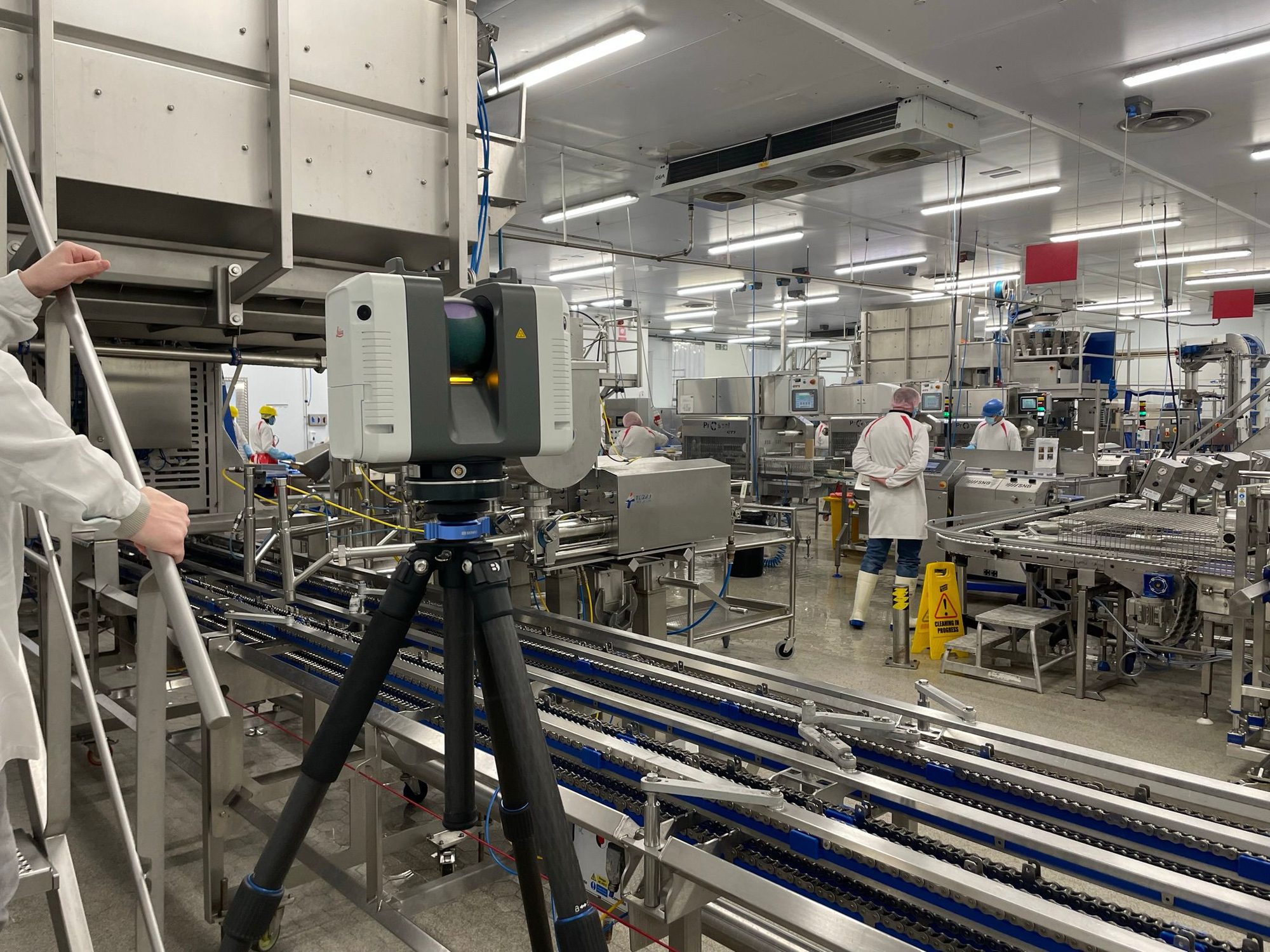
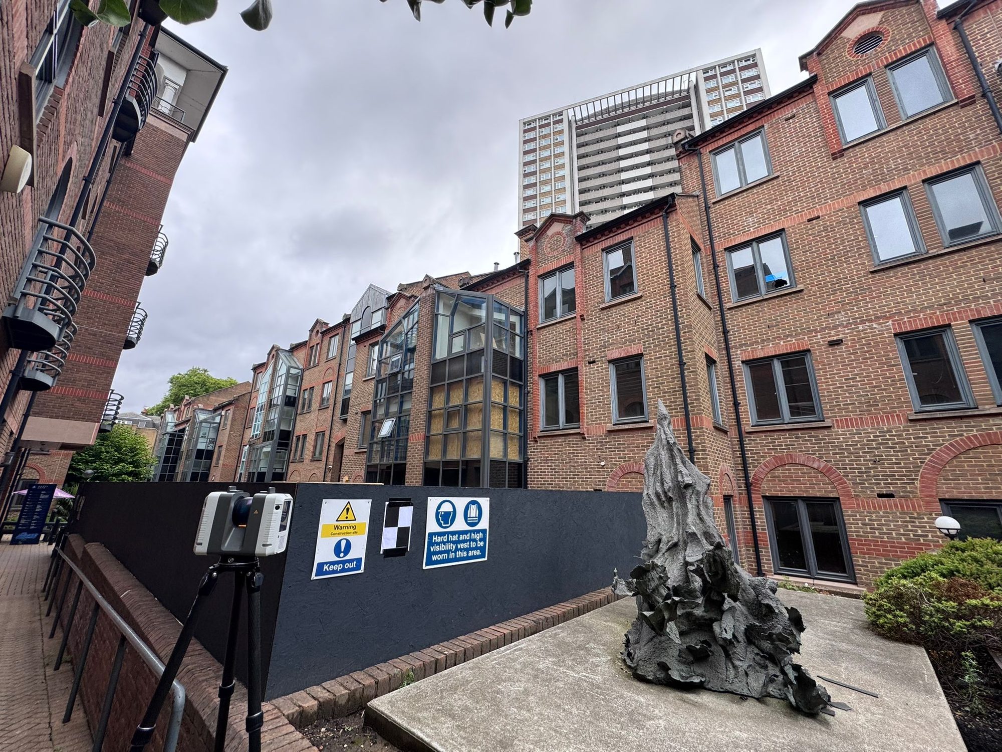
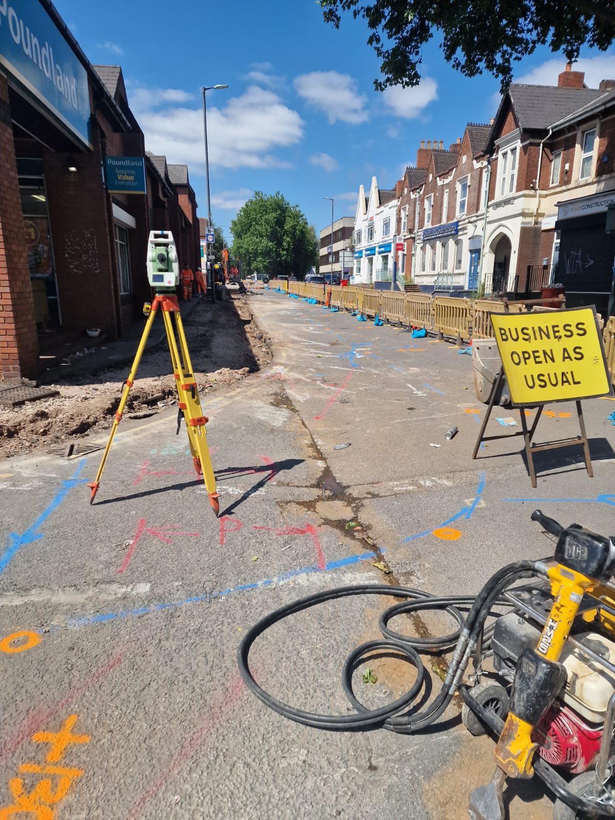
Our team, equipped with the latest Leica total stations, GPS receivers and 3D laser scanning equipment, embarks on a thorough inspection of the designated area. All data is referenced to Ordnance Survey coordinates and levels where required. We deliver in AutoCAD DWG format as standard, with clear annotation and layering.
Survey Deliverables
Everything you need for planning and design
Contour Mapping
Detailed contour lines showing the terrain profile, slopes and drainage fall across your site.
Feature Mapping
Every man-made and natural feature plotted: buildings, trees, fences, manholes, kerbs and more.
OS Coordination
All data referenced to Ordnance Survey national grid and levels for compatibility with other datasets.
CAD Deliverables
Fully layered AutoCAD DWG files with clear annotation, ready for your design team to work with.
How We Deliver Your Survey
Consultation
We review your requirements, assess the site and provide a detailed quotation.
Site Survey
Our qualified surveyors visit the site with the latest equipment to capture accurate data.
Data Processing
Raw data is processed, quality-checked and prepared in your required format.
Delivery
Completed survey data delivered on time, with full support for any follow-up queries.
The Red Box Advantage
Calibrated Equipment
Professional-grade instruments maintained and calibrated for accurate, defensible results.
Expert Surveyors
90+ years combined experience. CSCS certified, fully insured and professionally qualified.
Fast Turnaround
Most surveys completed and delivered within 5-10 working days. Rush options available.
Fixed Pricing
Clear quotes upfront with no hidden fees. You know exactly what you pay before we start.
Fully Accredited
SSIP, CHAS, CSCS certified. Members of The Survey Association with full professional insurance.
UK-Wide Coverage
Nationwide service from our head office in Cheshire with satellite offices across the UK.
Why Choose Red Box Surveys
90+ Years Combined Experience
Our senior management team brings over 90 years of surveying experience, ensuring every project meets the highest standards.
Nationwide Coverage
With satellite offices across the UK, we deliver efficient, cost-effective services wherever your project is located.
Latest Technology
We use advanced 3D laser scanning, GPS and GPR equipment to deliver precise, reliable data every time.
Frequently Asked Questions
A topographical survey maps the natural and man-made features of a piece of land in both 2D and 3D. It captures contours, elevations, buildings, roads, trees, drainage, boundaries and any other notable features, producing accurate, true-to-scale representations of your site.
You'll typically need one before any development project, planning application, land sale, infrastructure project, flood risk assessment or environmental study. Architects, engineers and planners require this data as a foundation for design work.
Our surveys are typically accurate to within 5-10mm for detail positions using GPS and total station equipment. For higher precision requirements, we can deploy 3D laser scanning for sub-millimetre accuracy. All data is referenced to OS coordinates and levels.
A typical residential plot takes half a day to a full day on site. Larger commercial or infrastructure sites may take several days. We provide estimated timescales at the quotation stage and always work to agreed deadlines.
We deliver in AutoCAD DWG format as standard, fully layered with clear annotation. We can also provide PDF plans, 3D models and exports compatible with Revit, Civil 3D and other design software.
Yes. We regularly survey sites of 50+ acres using a combination of GPS, total station and laser scanning technology. Our team is experienced in managing large-scale survey programmes efficiently, coordinating phased site access where needed.
Get a free quote
Ready to discuss your project? Fill in the form and our team will get back to you with a detailed quotation, typically within 24 hours.