Trial Holes
Reliable trial hole investigations delivered by an experienced, fully accredited team. We verify what your GPR data is telling you, confirm service depths and conditions on site, and get the results back to you fast so your programme stays on track.
Get a free quote- PAS 128 Quality Level A verification
- GPS-positioned service locations
- Depth and condition records
- Photographic evidence packs
- CAD drawings of verified positions
- HSG47-compliant reports
- Reinstatement to specification
- Same-day preliminary findings
Integrated With Your Utility Survey Programme
Most of our trial hole work follows on from GPR and EML surveys we’ve already carried out on site. That continuity matters. Our excavation team works from the same data, the same coordinate system and the same project understanding, so there’s no duplication and no miscommunication between survey phases.
Where you’ve commissioned utility detection from another provider, we’re equally comfortable working from third-party data. Either way, you get targeted excavations at the locations that actually need verification, not a scattergun approach that wastes time and budget.
On-Site Delivery You Can Rely On
Our operatives are CSCS carded, NRSWA qualified where required, and hold relevant confined space and excavation competencies. They turn up on time, work cleanly, and communicate clearly with your site team throughout.
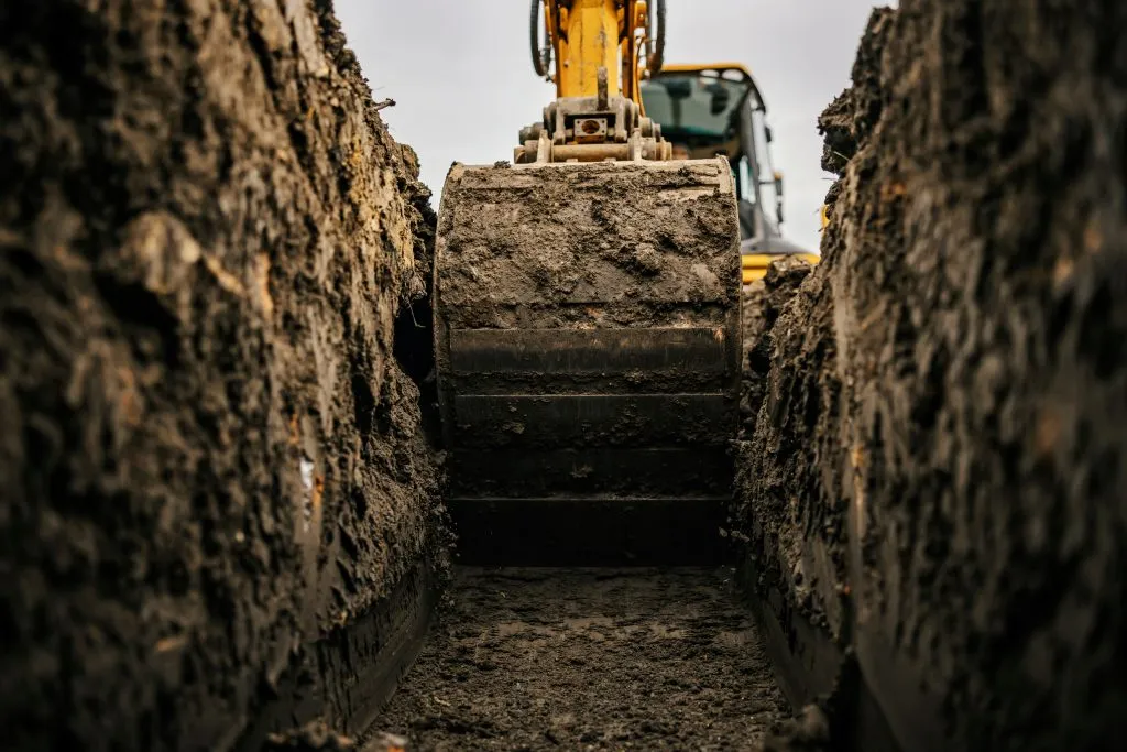
We carry out both hand and mechanical excavation depending on site conditions and proximity to known services. Every excavation follows HSG47 guidance and your site-specific risk assessments. Reinstatement is completed to match existing surface conditions, or to NRSWA specification for highway works.
Data You Can Design From
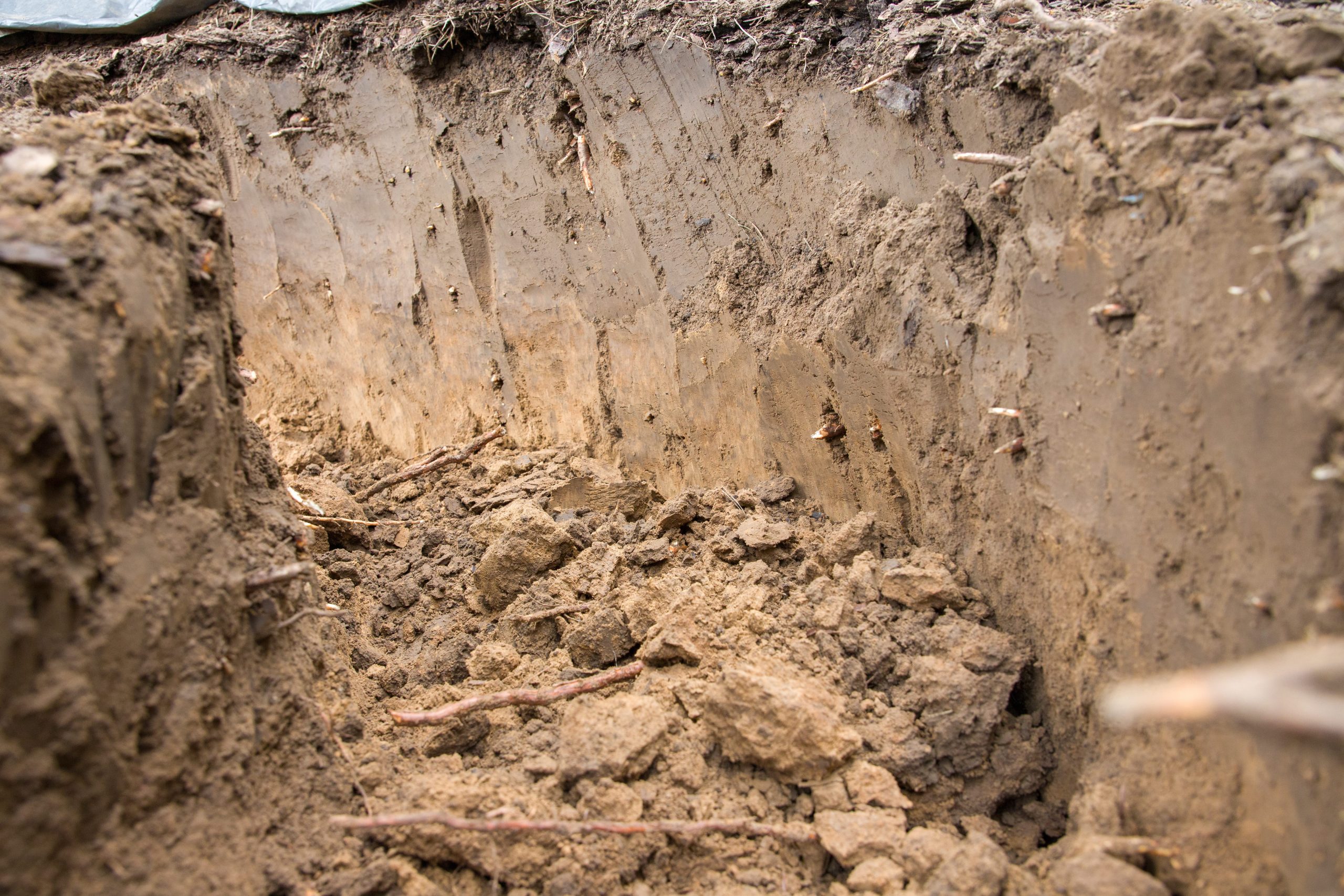
Each exposed service is GPS-positioned to OS coordinates, photographed with scale references, and recorded with depth, material, diameter and condition data. You get a full report with CAD drawings showing verified utility positions alongside your existing survey data.
Preliminary findings are available the same day where needed, with the full report and drawings following within your agreed programme. If something unexpected turns up on site, we’ll call you before we leave, not bury it in a report you read next week.
Investigation Methods
Safe, precise excavation techniques
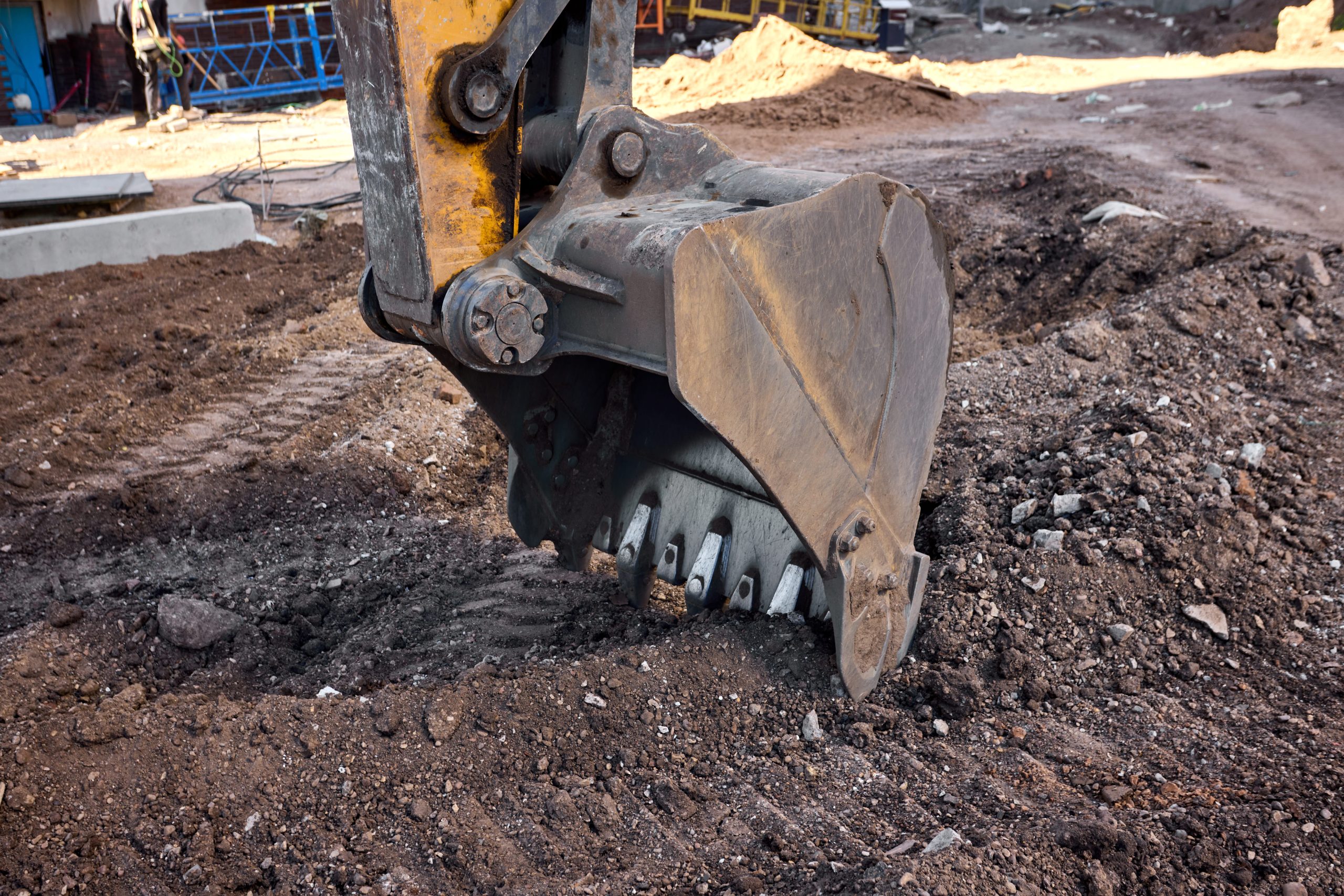
Hand Excavation
Careful hand digging near known services to avoid damage while exposing utilities.
Mechanical Excavation
Mini excavators for efficient digging in areas clear of known services.
GPS Positioning
Accurate positioning of exposed services referenced to OS coordinates for CAD plotting.
Photographic Evidence
Full photo documentation of exposed utilities showing depth, condition and material.
How We Deliver Your Survey
Consultation
We review your requirements, assess the site and provide a detailed quotation.
Site Survey
Our qualified surveyors visit the site with the latest equipment to capture accurate data.
Data Processing
Raw data is processed, quality-checked and prepared in your required format.
Delivery
Completed survey data delivered on time, with full support for any follow-up queries.
The Red Box Advantage
Calibrated Equipment
Professional-grade instruments maintained and calibrated for accurate, defensible results.
Expert Surveyors
90+ years combined experience. CSCS certified, fully insured and professionally qualified.
Fast Turnaround
Most surveys completed and delivered within 5-10 working days. Rush options available.
Fixed Pricing
Clear quotes upfront with no hidden fees. You know exactly what you pay before we start.
Fully Accredited
SSIP, CHAS, CSCS certified. Members of The Survey Association with full professional insurance.
UK-Wide Coverage
Nationwide service from our head office in Cheshire with satellite offices across the UK.
Why Choose Red Box Surveys
90+ Years Combined Experience
Our senior management team brings over 90 years of surveying experience, ensuring every project meets the highest standards.
Nationwide Coverage
With satellite offices across the UK, we deliver efficient, cost-effective services wherever your project is located.
Latest Technology
We use advanced 3D laser scanning, GPS and GPR equipment to deliver precise, reliable data every time.
Frequently Asked Questions
Yes, and that's how most clients use us. A combined desktop study, GPR survey and targeted trial holes gives you the most reliable utility data in a single mobilisation. We can also carry out standalone trial hole investigations from third-party survey data.
All operatives hold CSCS cards and relevant excavation competencies. For highway works, our team carries NRSWA qualifications. We're SSIP and CHAS accredited, and full members of The Survey Association.
Typically within 3-5 working days of instruction. For urgent requirements we can often mobilise faster. Preliminary findings are available on the day of excavation, with the full report following within your agreed programme.
Yes. All excavations are reinstated to match existing surface conditions. For works in the highway, we comply with NRSWA reinstatement requirements and can coordinate any necessary permits.
CAD drawings (DWG/DXF) with verified utility positions referenced to OS coordinates, a full written report, and a photographic evidence pack. We can adapt deliverables to match your project BIM requirements if needed.
Get a free quote
Ready to discuss your project? Fill in the form and our team will get back to you with a detailed quotation, typically within 24 hours.